
Achill, wind-swept and bare, heavily peat-covered, with great gaunt brown mountains rising here and there, and a wild coast hammered by the Atlantic on all sides but the east, has a strange charm which everyone feels, but no one can fully explain.
— Robert Lloyd Praeger, geologist
The drive from Westport to Achill is not an overly long one, within an hour or so I am crossing the bridge to this unique island that has become familiar to me after two summers of archaeological fieldwork. Achill is the largest and westernmost island off the coast of Ireland. It juts out towards the Atlantic, dividing Blacksod Bay to the north from Clew Bay to the south. The island is separated from Corraun Peninsula on the mainland by Achill Sound, a narrow tidal inlet known for its dangerously swift currents. The island was connected to the mainland in 1888 by a swing bridge, allowing small sailing craft to continue to use this shorter route between the two bays.
Long renowned for its friendly communities, magnificent vistas and dynamic coastline, Achill is today a relatively well-known tourist destination which sees a regular influx of visitors during the summer months, while somehow still managing to retain a sense of isolation. The island’s natural beauty can be astounding, boasting Europe’s tallest sea-cliffs and lowest glacial lake. The ever changing skies, with their mountain-shrouding mists and colorful sunsets, have long attracted and inspired artists and writers. Even when it is cold and rainy, there is always something remarkable to see in the sky, and on those cherished days when the weather is sunny, the sky clear, and the sea deep blue those who didn’t know better would swear they were on an island in the Caribbean. Another unique feature is that during June it doesn’t get dark here until after 11 pm, due to the northerly position of the island.
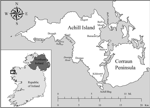
Cliffs along the Atlantic Drive.
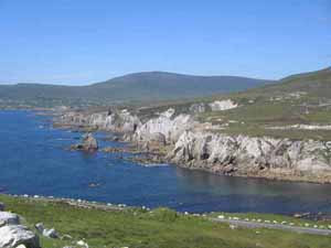
Sea-cliffs at Saddle Head, reportedly the highest in Europe.
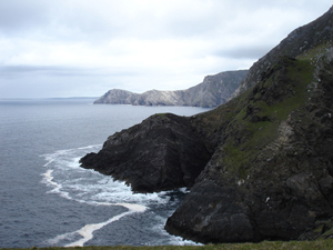
The lake known locally as “The Devil’s Cloak,” at Annagh on the north side of Achill. This is reportedly the lowest correy or glacial lake in Europe. The mountain in the background is Slievemore, the tallest on the island.
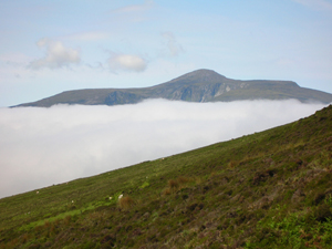
Mist creeping over the mountains.
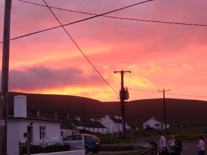
Sunset over the village of Dooagh.
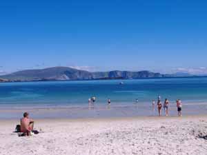
The strand or beach at Keem Bay.
Archaeological evidence suggests that Achill has been continuously habited since at least the Neolithic, and its archaeological landscape features a wide range of sites including megalithic tombs, cashels, promontory forts, ogham stones, the ruins of several booleying villages, nineteenth-century manor houses, a fifteenth-century tower house, and a single crannog. An ongoing excavation and annual Field School sponsored by the Achill Folklife Centre has brought much attention to Achill’s archaeology and history, though until recently the island’s rich maritime heritage has been mostly under-appreciated.
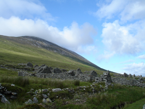
The Deserted Village, a nineteenth and early twentieth settlement on the slopes of Slievemore whose name remains unknown to history.
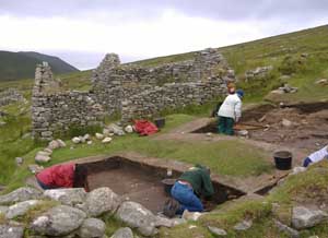
The Achill Archaeological Field School has conducted excavations at the village for over a decade.
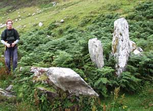
The megalithic tomb at Annagh, a ceremonial and burial structure dating to the Neolithic period, ca. six thousand years old.
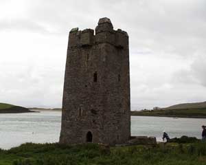
The 15th century towerhouse known as Kildavnet Castle, guarding the southern entrance to Achill Sound. This was built as one of a chain of fortifications throughout Clew Bay by the O’Malley family, whose most famous member was Grace O’Malley the infamous Pirate Queen.
For now I drive to the far end of the island, to the village of Dooagh, where I will be staying. For the two previous years I stayed in the Folklife Centre’s facilities, with Field School staff and students. These are also located in Dooagh. This year, with financial support from the Irish Heritage Council, I will be renting a house of my own in the village. This will allow for an increased number of archaeologists participating in the maritime archaeological survey. Three other divers will be joining me during the month of July, more than I have had in the two previous summers of research.
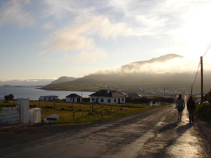
The road to Dooagh.
I am renting this house from the MacNamara family, who live next door. Like most of the islanders, their family has lived in this village for generations, and they are outgoing and very friendly. The house is perfectly suited for a research headquarters, with two bedrooms for project archaeologists and visitors, common areas that can be converted to an archaeological lab and dive locker, a fireplace for cozy turf fires, and a large kitchen. The house faces Clew Bay and the Atlantic Ocean, and the views from both the front and the back are great. Once settled in, I’m ready to greet my Achill friends, and prepare for a successful summer of research. Did I mention that the house is located one house away from Gielty’s Pub . . . ?
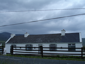
The headquarters of the Achill Maritime Archaeology Project in Dooagh.
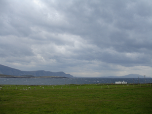
View from the front of the house, facing south across Clew Bay and the Atlantic. The Minaun Cliffs are on the left, where the ship Neptune wrecked in 1860. On the horizon to the right is Clare Island, the final resting place of the Spanish Armada ship El Gran Grin.
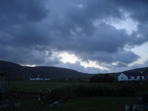
Even the view from the back yard is dramatic on this island.