Achill Island Field Report 9: Arrival of Kevin and Lecture in Westport, 28-29 June 2006

On the 28th I’m driving to Westport to pick up Kevin Cullen, an archaeology graduate student at the University of Wisconsin-Milwaukee. He is Irish-born, but emigrated to America when he was young, and it has been eight years since he’s been back to Ireland. He is also a diver, and will be participating in the project through the end of July.

Kevin.jpg

In addition, I am going to be presenting a lecture on the maritime archaeology of Clew Bay to the Westport Historical Society on the following day. My friends and hosts in Westport, the Shanley family, suggested the community would be interested in my research, and they arranged the event with the help of Aiden Clarke of the Clew Bay Heritage Centre. As it turns out, they have asked me to be the inaugural speaker for a new lecture series established in honor of Jarleth Duffy, a prominent member of the Westport Historical Society. Mr. Duffy recently passed away, and it is obvious from talking to locals in Westport how respected he was, and how instrumental he was in the operations of the Historical Society and Heritage Centre. The lecture has been well-advertised, and we are hoping to have good attendance. Here is the announcement in the local paper, the Mayo News.

lecture.jpg

Here is the opening slide for my presentation at the new Plaza hotel. It went very well, and enough people showed up so that it was standing room only. Afterwards, lots of folks made their way through the crowd to share with me their own interest in Clew Bay’s maritime history, and a number have provided me with information useful to my research here. Events like these are important for both archaeologists and local communities, because after all it is these people’s history that I am exploring. It is worth sharing, and local knowledge always helps shape our understanding of the archaeology we do.

Intro.jpg

After the lecture, I pose for a photograph with some Westport Historical Society notables. From left to right is Sheila Mulloy, John Mayock (Chairman of the Historical Society), myself, Anne Duffy (widow of the late Jarleth Duffy), Kitty O’Malley Harlow, and John Mulloy (President of the Historical Society). They have generously presented me with a gift of a number of the Society’s published journal, which were selected to include the best of maritime history articles.

afterlecture.jpg

Photograph by Aiden Clarke

Kevin and I stay one more night in Westport, and then head out to Achill the following day. Things are beginning to get exciting around here, as with another team member we can accomplish a lot more work in the field.

Achill Island Field Report 8: Archaeological Tour of Clare Island, 25 June 2006

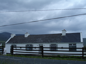
A few days ago, my landlady Sheila McNamara brought to my attention an announcement in the Mayo News about a free archaeological tour of Clare Island being hosted by the Clew Bay Archaeological Trail (www.clewbaytrail.com). This trail, which encompasses 21 archaeological sites including megalithic tombs, Bronze Age cooking sites and promontory forts, medieval churches, and a 16th century tower house, was set up to introduce visitors to the rich archaeological heritage of the southern portion of Clew Bay. It stretches 35 km from Westport through Murrisk (west of Westport on the southern shore of Clew Bay), further west to Louisburgh, and then (via ferry) to Clare Island.


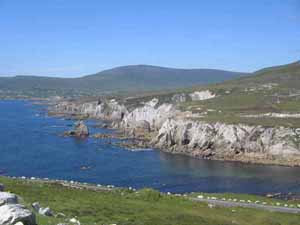
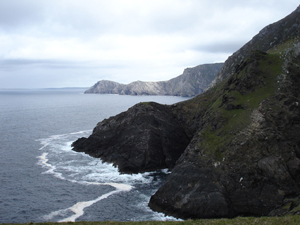
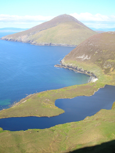
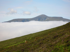
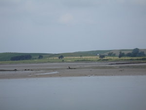
Clare Island is the largest island in Clew Bay other than Achill. Located some 5 km from the mainland, it is accessible only by boat. The dominating feature of the island is a ridge running from east to west, attains a height of 462 m at Knockmore mountain, and features vertical sea cliffs alternating with steep grassy slopes along the northwestern shore, the spectacular view I see regularly from Dooagh in Achill. Clare Island has long been recognized for its diverse plant and animal species, geological features, and archaeological sites, and was the site of a major series of scientific studies in the early 20th century.

clare.jpg

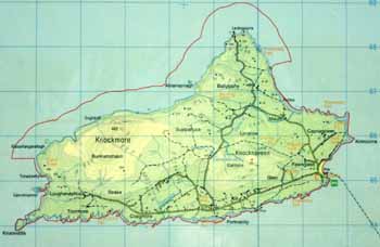
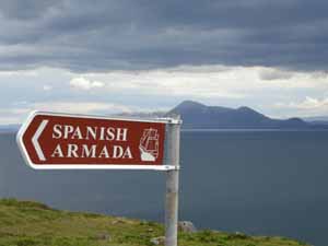
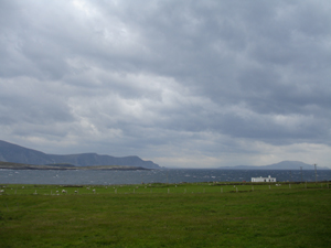
Having long seen it dominate the horizon from the southern coast of Achill, I have always wanted to visit this island. It lies within ten miles of Achill, and the two have a long intertwined history. This archaeological tour is a great excuse to visit the island and learn more about its history, and on Sunday morning I wake up early enough to make the drive around Clew Bay to the town of Roonagh to catch the 11 am ferry to the island.

ferry.jpg

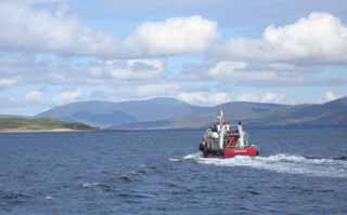
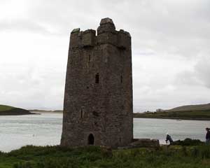
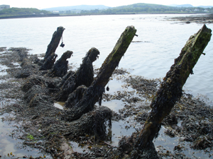
As we approach the island in the ferry boat, a squat grey stone structure looms overhead. This is a type of castle common in Ireland from the 14th through 16th centuries known as a tower house. Clare Island and the 16th century tower house that dominates the harbor are always associated with the great maritime clan of O’Malley (Ui Mhaille), and especially the famous “pirate queen” Grace O’Malley, known in the Irish annals as Granuaile (pronounced “Gran-yah-whale”).

tower view.jpg

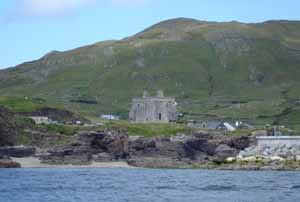
The O’Malleys controlled a vast area of the western Irish coast from Galway to Donegal Bays, and guarded their territorial waters jealously with a mighty fleet of Irish war-galleys. “Power by land and sea” was the family motto. This tower house is one of a series built by the O’Malley clan, in order to perpetuate their control of the maritime landscape. Another, smaller tower is located at the southern entrance to Achill Sound at Kildavnet on Achill. A third tower, comparable in size to the one on Clare Island and known to have been a residence of Grace O’Malley, is located at Rockfleet on the northern coast of Clew Bay, between Mulranny on the Corraun Peninsula and the town of Newport (which is north of Westport).

tower.jpg

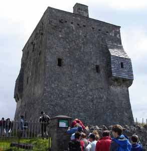
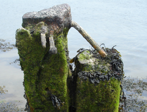
Tower houses were typically designed as three-story rectangular defensible residences, featuring a vault over the ground floor and topped by a thatched or pitched slate roof. The roof was protected by a battlement parapet over the entrance, so that defenders could drop projectile weapons directly onto their attackers below. The walls were so thick that features such as staircases and garderobes (bathrooms) were encased within them.

walls.jpg

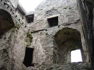
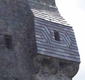
This late medieval castle was converted in 1826 to a Coastguard and police barracks. It was at this time that the purple slate flashing was added to the two bartizans (roofed, floorless turrets). Its function as a symbol of power on the maritime landscape would have been retained in this 19th century context, though from that point on it represented British rather than Irish hegemony.

slate.jpg

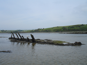
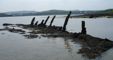
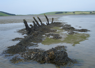
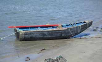
Leaving the tower, we walk along the harbor, passing a number of fishing boats including a curragh. These famed Irish vernacular watercraft have an ancient ancestry, and were originally built by stretching hides over a wicker framework. By the nineteenth century, tarred canvas was used over a light wooden framework. Curraghs are still built on the island, as they are on neighboring Achill and Corraun peninsula. Each island and coastline has its own traditional curragh styles, so those built on Clare differ slightly from those built on Achill or the Aran Islands or elsewhere.

clarecurragh.jpg

The harbor was always a focal point for maritime activity on the island. These historic photographs, taken ca. 1890s, show two views of the harbor and the tower house. Vernacular boats used by Clare islanders, including curraghs and hookers, can also be seen. The hundreds of barrels visible in these images were used to pack fish. A British government agency known as the Congested Districts Board had been set up in the 1890s to improve the local economy, and one of its projects was to establish a fish curing station on Clare.

19thCpier.jpg

19thCharbor.jpg

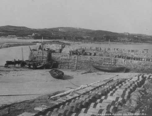
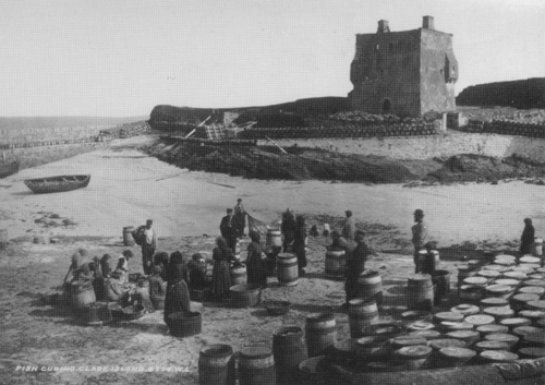
Historic photographs courtesy of the John O’Shea Collection

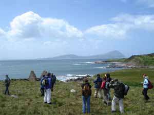
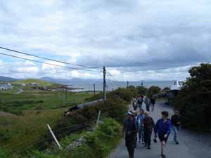
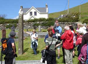
After stopping in the local community centre for tea and biscuits, we commence with the walking tour of the island and visit a number of other archaeological sites. Clare Island has a rich archaeological landscape, with a wide variety of sites including one megalithic tomb, ten promontory forts, iron age huts and field systems, more than 50 fulachta fiadh (bronze age cooking sites), and a medieval abbey, which we are headed to now. Sixty-five people have shown up for the free tour, much more than expected. It has turned out to be a beautiful day.

walking.jpg

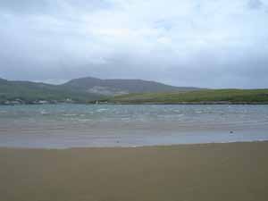
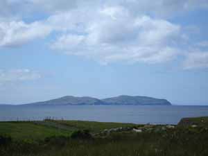
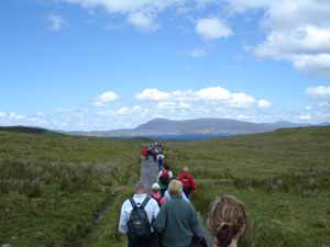
On the horizon to the southwest is the island of Inishturk.

inishturk.jpg

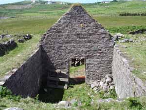
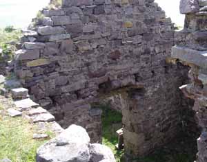
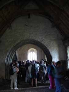
We come to a church known as the Carmelite Abbey. It was founded in the thirteenth century as a cell of Knockmoy, County Galway. The present building dates to the fifteenth century and consists of a chancel, nave, and sacristy.

church.jpg

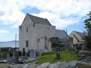
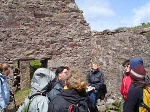
Bronach Joyce, of the Westport Historical Society and Clew Bay Heritage Centre, points out an early medieval standing stone in the graveyard in front of the church. She is one of the tour guides.

standing.jpg

No pictures are allowed further inside the church. This is to protect a series of medieval paintings on the ceilings and walls. They are of a style unique among medieval churches, and feature images of greyhounds, dragons, knights on horseback, bards with harps, bulls, and other animal and human figures. There is also an ornate stone tomb, adjacent to a large stone wall plaque carved with the O’Malley family crest. It is believed by locals to be the tomb of the pirate queen Grace O’Malley herself.

inside.jpg

The tour continues as we head to the north side of the island.

tour.jpg

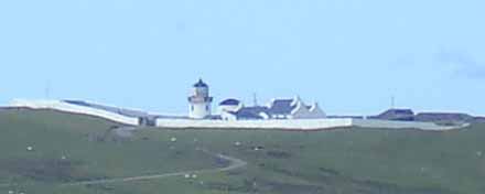
Off in the distance we see the Clare Island Lighthouse. Like lighthouses everywhere, this aid to navigation was vitally important for trade and shipping in Clew Bay. The lighthouse is no longer an active beacon. It operated for a time as a bed and breakfast, and is now a private residence.

lighthouse.jpg

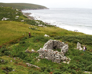
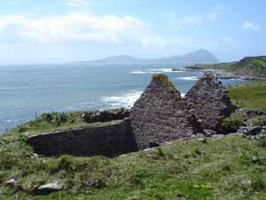
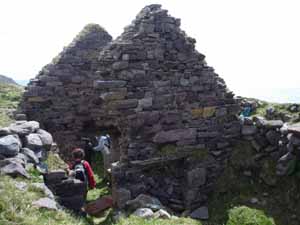
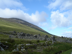
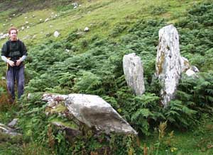
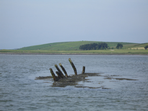
This mound and ring of stones are the remains of a megalithic tomb, built by Neolithic farmers to bury their elite. It is of a type known as a court tomb, because the stones are arranged to create an open-air court in front of the tomb entrance. It is believed that this reflects the communal nature of the funerary rituals or ceremonies that probably took place here, some 5,500 years ago. In the background are the remnants of early field walls, which might also date to this period. This megalithic tomb indicates there was a farming community on Clare Island at that time. Several megalithic tombs are also present on Achill. While examples of Neolithic watercraft (logboats or dugout canoes) have been discovered in Ireland, we know very little of early Irish seafaring. Clearly boats, likely skin-boats similar to the curraghs in use today, were used to reach these islands, but they have left no trace in the archaeological record.

tomb.jpg

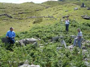
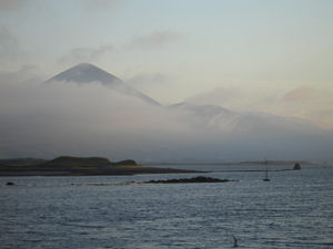
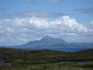
The view from the tomb of the distant mountain Croagh Patrick is spectacular. Megalithic tombs were often situated to take advantages of vistas such as this, suggesting a sacred connection with prominent features of the surrounding landscape. Croagh Patrick has long been considered a holy mountain and pilgrimage site , and is today associated with St. Patrick, who brought Christianity to Ireland. Bronze age and other early sites on top of the mountain suggest that it was considered a sacred landscape thousands of years earlier.

croaghpatrick.jpg

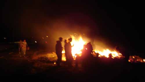
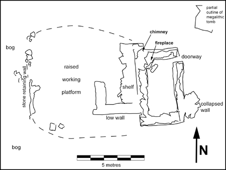
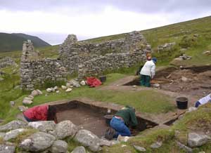
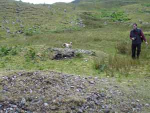
A very short walk from the Neolithic tomb is another site, a bronze age open-air cooking site known as a fulachta fiadh. This was used by farmers 2500 years ago to boil water in what may have been a communal event. A hole in the ground, near a natural water source (in this case, a small spring), was filled with water. Then a massive fire was used to heat stones until they were extremely hot. The heated stones were continually dropped into the water until it was brought to boiling point. Meat, probably wrapped in straw, was lowered into the boiling water and cooked. Experimental archaeologists have reconstructed this process and have cooked meat in almost as little time as it would take on a modern stovetop. After use, the old stones were removed from the hole so it could be re-used, forming the horseshoe-shaped mound around the hole seen in the picture below. Some researchers think fulachta fiadh were also used as community saunas. There are 53 fulachta fiadh identified by archaeologists on Clare Island.

fulachta fiadh.jpg

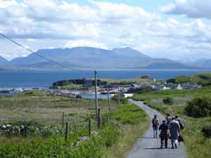
Around 4 pm we head back to the harbor, overlooked by the O’Malley tower house.

return.jpg

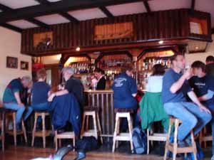
After four hours of walking, we have built up quite a thirst, which we quench at the local pub before taking the ferry back to the mainland.

pub.jpg

Achill Island Field Report 7: St. John’s Eve: Bonfire Night, 23 June 2006

After another low tide recording the Successful wreck at Achill Sound, I am looking forward to participating in a traditional Irish event, St. John’s Eve, also known as Bonfire Night. School kids and adults alike can’t hide their excitement over the upcoming conflagration. At various locations throughout Achill, and over the entire country, massive piles of refuse are collected and, around midnight, will be set alight in a series of huge bonfires.


I am attending the westernmost bonfire in all of Ireland, at the western end of Dooagh. All day long tractors are seen going back and forth on the roads with loads of combustible materials. It is a convenient way to dispose of mattresses, broken furniture, and other rubbish in an area so remote that garbage service is not available to or adequate for every household. It seems likely to me that this tradition, which dates to pagan times, may have always been a way to dispose of refuse generated in the prior year. It certainly has always been an important and fun social gathering for entire communities.

bonfire.jpg

Tonight’s Bonfire is no exception. Virtually the entire village has come to enjoy the blaze, which puts off a good deal of heat on an otherwise cold night. Children run amok against a background of flame and heat ripples, American archaeology students mingle with locals, men heave nightstands, sofas, and chairs into the burning maw, and ladies make their way through the crowd with platters of sausages and other treats. As the night wears on, the kids go off to bed and a hard core group lingers, lounging on a couch that has thus far escaped the fire, singing traditional Irish songs and enjoying what is known in Gaelic as “craic” (pronounced “crack,” it means simply good times or great fun). The craic goes on this year until around 4 am . . .

Prehistoric Artifacts Found In Blue Hill Bay, Maine

Fishermen Interviews by East Carolina University Graduate Reveal Locations of Prehistoric Artifacts and Shipwrecks

In June 2006, Franklin Price (M.A.) of Bernard, Maine, and recent graduate of East Carolina University, received a grant from IMH and the Fund for the Preservation of Maine’s Maritime Heritage (http://www.maritimehistory.org/support.html) interview fishermen about the locations of shipwrecks and submerged prehistoric sites in Blue Hill Bay, Maine. “Fishermen know their coasts and fishing grounds. The fishing community is as likely as any to know the locations of cultural resources within their fishing areas,” says Price. In fact, scallop draggers from Blue Hill Bay in the 1980s and 1990s recovered stone biface tools from depths of up to nearly 200 feet below sea level. A recent interview by Price revealed other remarkable examples of Native American gouges and a spear point that were hauled by a Blue Hill Bay scallop dragger from approximately 20-30 meters below sea level. These new finds are tentatively dated to ca. 8,000 – 6,000 BP.

With recent reports of prehistoric finds in the region, interviews with fishermen have some immediacy. As transitions in the fishing industry, most notably the collapse of some fisheries, have led to shifts in fishing techniques, knowledge about historic and archaeological sites could easily be lost to time. Although the lobster fishery in the area still thrives, others have all but disappeared, including the scallop and cod fisheries. These fisheries exposed their participants to a different kind of endeavor than lobstering, using different gear, at separate locations, and potentially exposing them to submerged cultural resources. Almost all of the fishermen of the Blue Hill and Frenchman Bay region now rely on lobstering for their livelihood. As a result, knowledge gained during the pursuit of other fish is being forgotten, lost to time as the older generation of fishermen age and pass away. This knowledge includes the positions of submerged prehistoric sites, shipwrecks, and historic waterfront areas. 

There is a significant gap in the prehistory and archaeological record of the Gulf of Maine coast. The earliest-known and scientifically-dated coastal archaeological site is the Turner Farm Site on North Haven Island in Penobscot Bay (5290 ±95 BP). Before this time is a relatively undocumented 5,000 year period of coastal prehistory from the PaleoIndian to the Late Archaic Period (ca. 10,000 – 5,000 BP), which could be filled, at least partially, by the discovery of inundated prehistoric archaeological sites. The interview work by Price has verified the presence of a now submerged prehistoric landscape in Blue Hill Bay, Maine. Price and IMH hope to continue interviewing fishermen and collecting archaeological data next year, which can be the basis for SCUBA and remote sensing surveys of areas where prehistoric finds have been reported by fishermen.

Achill Island Field Report 6: 19th century Ice House on Corraun, 21 June 2006

Today I have joined the Achill Archaeological Field School students for their weekly field trip, lead by Field Director Simon O Faolain and Managing Director and Field School founder Theresa McDonald. The students will be traveling to Corraun to see a number of historical and archaeological sites. Theresa has promised to show me a stone structure used as an ice house for Achill’s 19th century commercial fishing industry. This commercial marine activity was introduced to Achill by a Scotsman named Alexander Hector, who came to the island in 1855 to start a salmon-fishing venture.


Hector’s operations were located on various coasts throughout Achill and the neighboring Corraun peninsula. Last year we documented one of Hector’s fishing stations built at Annagh (north side of Achill), known locally as the “Scotch House.” This complex included a stone one-room structure with a fireplace and chimney, with an adjacent raised platform bounded by retaining walls that delineated a working area. Part of this space was further divided by a low stone wall extending from the building, and a shelf running along the exterior wall of the building. Hector introduced a device known as the bag net which proved very successful at catching large quantities of salmon. He had several bag nets deployed offshore Annagh and a number of other places along the coast. The ruined complex at Annagh, like those that once existed at Keel and elsewhere, would have served as a staging and working area for Achill fishermen, who would have used Hector’s boats and equipment and been supervised by Scottish overseers. The Annagh station may have been used to house fishermen or overseers, to store and maintain boats and other equipment, or to process fish and prepare it for transport to a centralized curing station at Keel or Achill Sound.

Scotch house.jpg

Ruins of the fishing station at Annagh on the north coast of Achill.

SHsiteplan.jpg

Site plan of the Annagh fishing station, known as the “Scotch House.”

Hector also had men and nets working several areas of Corraun’s coast. Corraun is the large peninsula on the mainland adjacent to Achill. Part of Achill Parish, Corraun has always been associated with Achill. At least one structure related to Hector’s activities remains on Corraun, the ruined remains of an ice house. Like Achill, Corraun features beautiful scenery and a wide variety of historical and archaeological sites.

After their morning lecture, I join the Field School students as we set out from Dooagh on the bus. Once we pass the town of Mulranny we turn south to follow the southern coastline of Corraun back towards Achill. Along the way we pass a site where an Spanish Armada ship, the San Nicolas de Prodaneli, reportedly was wrecked after this famous failed invasion in 1588.

sign.jpg

If only it were this easy to find an Armada shipwreck! The San Nicolas de Prodaneli, named after her commander and probable owner Marin Prodanelic, was an 834-ton merchant carrack built in Ragussa, or present-day Dubrovnic, Croatia. A member of the Levant (Mediterranean) Squadron, she boasted 26 guns and 355 men. Evidence in the archival records suggest she was wrecked at a place called “Fynglasse,” which is believed to be a location known as Tourglass on Corraun. Local memory also suggests a Spanish ship went down here. In future years we may return to search for this shipwreck, with sophisticated geophysical or remote sensing equipment such as a side scan sonar and magnetometer.

Continuing along the scenic drive along Curraun’s rugged coastline, we stop at a place known as Dooaghbeg, where the students file out of the bus and march down to the sea-cliffs. The two gables of the ice house can be seen ahead, protruding out of the ground by the sea. In the background is Clare Island.

21JUN06_006.jpg

Upon closer inspection, we can see that the bulk of this structure is underground, which makes sense for a building designed to store ice for extended periods of time. Hector’s bag nets were so effective that it became a challenge to preserve large quantities of salmon long enough to transport it to a centralized curing facility located at Achill Sound. The ice stored in this semi-subterranean structure would have been used to temporarily preserve the fish, which might also have been stored in this building.

icehouse.jpg

21JUN06_013.jpg

21JUN06_037.jpg

According to documents and local memory, Hector’s employees at Keel village on Achill cut ice from Keel Lake during the winter, which would have been stored at an ice-house there. This indicates a significant climate change has taken place here since the 19th century, as the lake no longer freezes in the winter. At the ice house we are visiting today, ice was gathered by laborers who climbed to the top of Corraun mountain.

21JUN06_015.JPG

Field School founder Theresa McDonald reviews the history of Alexander Hector and his fishing operations on Achill to the students gathered inside the ice-house.

21JUN06_022.JPG

A series of mortises or put-log holes indicate the placement of a second-story floor located just above the interior doorway lintel. It is most likely that ice was stored below, but the function of the upper room remains unknown. This may have been storage for casks or other devices used to pack the fish.

21JUN06_064.JPG

After leaving the ice-house, we walk along Corraun to a beach facing the Sound dividing Achill from Corraun. Theresa points out a shell-midden that may date to the Mesolithic, a testiment to the long-standing maritime occupations of this region. We have a great view of the island of Achill Beg (“Little Achill”), which hides the 1894 wreck of the Norwegian bark Jenny, and Achill itself.

Achill Island Field Report 3: On to Achill, 09-12 June 06

Achill, wind-swept and bare, heavily peat-covered, with great gaunt brown mountains rising here and there, and a wild coast hammered by the Atlantic on all sides but the east, has a strange charm which everyone feels, but no one can fully explain.

— Robert Lloyd Praeger, geologist


The drive from Westport to Achill is not an overly long one, within an hour or so I am crossing the bridge to this unique island that has become familiar to me after two summers of archaeological fieldwork. Achill is the largest and westernmost island off the coast of Ireland. It juts out towards the Atlantic, dividing Blacksod Bay to the north from Clew Bay to the south. The island is separated from Corraun Peninsula on the mainland by Achill Sound, a narrow tidal inlet known for its dangerously swift currents. The island was connected to the mainland in 1888 by a swing bridge, allowing small sailing craft to continue to use this shorter route between the two bays.

AchillMap.jpg

Long renowned for its friendly communities, magnificent vistas and dynamic coastline, Achill is today a relatively well-known tourist destination which sees a regular influx of visitors during the summer months, while somehow still managing to retain a sense of isolation. The island’s natural beauty can be astounding, boasting Europe’s tallest sea-cliffs and lowest glacial lake. The ever changing skies, with their mountain-shrouding mists and colorful sunsets, have long attracted and inspired artists and writers. Even when it is cold and rainy, there is always something remarkable to see in the sky, and on those cherished days when the weather is sunny, the sky clear, and the sea deep blue those who didn’t know better would swear they were on an island in the Caribbean. Another unique feature is that during June it doesn’t get dark here until after 11 pm, due to the northerly position of the island.

cliffs.jpg

Cliffs along the Atlantic Drive.

Saddle Head.jpg

Sea-cliffs at Saddle Head, reportedly the highest in Europe.

Devils Cloak.jpg

The lake known locally as “The Devil’s Cloak,” at Annagh on the north side of Achill. This is reportedly the lowest correy or glacial lake in Europe. The mountain in the background is Slievemore, the tallest on the island.

misty mountain.jpg

Mist creeping over the mountains.

sunset.jpg

Sunset over the village of Dooagh.

beach.jpg

The strand or beach at Keem Bay.

Archaeological evidence suggests that Achill has been continuously habited since at least the Neolithic, and its archaeological landscape features a wide range of sites including megalithic tombs, cashels, promontory forts, ogham stones, the ruins of several booleying villages, nineteenth-century manor houses, a fifteenth-century tower house, and a single crannog. An ongoing excavation and annual Field School sponsored by the Achill Folklife Centre has brought much attention to Achill’s archaeology and history, though until recently the island’s rich maritime heritage has been mostly under-appreciated.

DesertedVillage.jpg

The Deserted Village, a nineteenth and early twentieth settlement on the slopes of Slievemore whose name remains unknown to history.

FieldSchool.jpg

The Achill Archaeological Field School has conducted excavations at the village for over a decade.

megalithic tomb.jpg

The megalithic tomb at Annagh, a ceremonial and burial structure dating to the Neolithic period, ca. six thousand years old.

towerhouse.jpg

The 15th century towerhouse known as Kildavnet Castle, guarding the southern entrance to Achill Sound. This was built as one of a chain of fortifications throughout Clew Bay by the O’Malley family, whose most famous member was Grace O’Malley the infamous Pirate Queen.

For now I drive to the far end of the island, to the village of Dooagh, where I will be staying. For the two previous years I stayed in the Folklife Centre’s facilities, with Field School staff and students. These are also located in Dooagh. This year, with financial support from the Irish Heritage Council, I will be renting a house of my own in the village. This will allow for an increased number of archaeologists participating in the maritime archaeological survey. Three other divers will be joining me during the month of July, more than I have had in the two previous summers of research.

Road2Dooagh.jpg

The road to Dooagh.

I am renting this house from the MacNamara family, who live next door. Like most of the islanders, their family has lived in this village for generations, and they are outgoing and very friendly. The house is perfectly suited for a research headquarters, with two bedrooms for project archaeologists and visitors, common areas that can be converted to an archaeological lab and dive locker, a fireplace for cozy turf fires, and a large kitchen. The house faces Clew Bay and the Atlantic Ocean, and the views from both the front and the back are great. Once settled in, I’m ready to greet my Achill friends, and prepare for a successful summer of research. Did I mention that the house is located one house away from Gielty’s Pub . . . ?

10JUN06_03.jpg

The headquarters of the Achill Maritime Archaeology Project in Dooagh.

10JUN06_04.jpg

View from the front of the house, facing south across Clew Bay and the Atlantic. The Minaun Cliffs are on the left, where the ship Neptune wrecked in 1860. On the horizon to the right is Clare Island, the final resting place of the Spanish Armada ship El Gran Grin.

10JUN06_05.jpg

Even the view from the back yard is dramatic on this island.

Achill Island Field Report: Discovery of the Westport Quay Wreck

The following evening we set out to the quay at low tide to look for the wreck that local historian John Mulloy told us was abandoned and exposed on the foreshore. My host Mr. Shanley has also seen this wreck, though like many people living on a historic waterfront he hasn’t given much thought to it until an archaeologist comes around asking questions about it. The weather has been sunny and beautiful, something that is not necessarily the norm in Ireland. At the end of the pier on Roman Island we see the mist shrouding Croghpatrick, a mountain with religious significance which has long drawn pilgrims to the area.

06JUN06_04_mistymountain.jpg

Ireland, unlike Florida where I am from, displays a significant tidal change. Around 8 feet of water goes out with the tide every six hours, exposing a large area of muddy ground that is known as the foreshore. This phenomenon is useful for maritime archaeologists, as it is easier to find shipwrecks and other maritime sites when large areas of the seafloor are visible. Even though the tide is beginning to come back in, it is not to hard to find the remains of this wooden vessel protruding from the mud off in the distance (in the center of this picture):

07JUN06_02_foreshore.jpg

After spotting the wreckage, we meet another local who tells us that when he was a boy someone told him the wreck was a vessel that was shipwrecked offshore the island of Inishturk. Much to the islanders chagrin, the hulk was taken from them by the Coastguard or “revenue men” and towed to Westport, where they were unable to sell it and it eventually was abandoned and burned. It is not uncommon to get conflicting stories concerning the identities of old shipwrecks. Either of these two stories could be true, partially true, or inaccurate. Was this wreck a lighter or a salvaged shipwreck? Closer inspection might help solve the mystery.

The following day I return to the quay in the morning, to catch the low tide. We have secured permission for me to borrow a small boat moored at the pier to get out as close as possible to the wreckage. As the boat is stored without its fuel tank, I use its oars to row out the long waterfront, much as generations of watermen did before me. Struggling somewhat in the tidal current and winds in a boat not designed for rowing, the process is too slow despite my eagerness. Gradually the wreck comes into view.

07JUN06_11_wreck1.jpg

By the time I reach it, the tide is coming in, but there is still time to take some photographs, make some observations, and record a few key measurements. The exposed wreckage represents a sizable vessel, measuring almost exactly 20 m (65.6’) in length, and it is at least 6 m (19.7’) wide.

07JUN06_27_wreck2.jpg

It is listing sharply to one side, though without further inspection we cannot tell which end is which, or to which side it leans. Its substantial timbers are covered in kelp, which is common in the summer months when it grows thickly on rocks and other submerged materials. One side is more or less intact, with frames or ribs exposed well above the mud, while most of its other side and indeed most of the hull itself is buried. The buried portion of the wreck likely has been well-preserved by the muddy sediments. We are not planning on digging any of it out, as its muddy covering is the best way to protect the timbers from deterioration.

07JUN06_13_wreck3.jpg

Many of the frames have survived on the exposed side of the vessel, and some extend upwards from the sediments as high as 1.85 m or about 6’. These frames provided structural strength to the ship, and their curvature defined the shape of the hull. The fact that they have survived to such a length means we will be more likely to reconstruct the original shape of the hull. A lighter would have typically been shallow-drafted or displayed a relatively flat bottom in order to negotiate shallow waters.

07JUN06_39_frames.jpg

The longitudinal timber visible in the above picture (running along the base of the frames) might be a keelson, or central strengthening timber. It is also possible that this timber is a stringer, or timber offset from the keelson, which in this case would be buried further beneath the mud. Taking the time to clear the kelp and closely inspect the hull will make it easier to distinguish which timber is which.

The frames measure 5” across (sided dimension) and 5 to 6” deep (molded dimension). Each frame is made up of various overlapping members attached to each other side-to-side. The shipbuilders used round-shanked transverse iron bolts to attach the frame pieces (futtocks and floors) to each other. When the frames were complete, outer hull planking was attached to the outer surface of the planks with square-shanked iron spikes. Round iron bolts were also used to hold this planking in place. They were driven through the plank, frame, and an interior set of planking known as ceiling planks. The picture below shows the outer surface of one frame pair. Visible are a transverse iron bolt which would have held a now missing frame member, and two planking spikes.

07JUN06_42_fasteners.jpg

Observing and recording these kinds of details will lead to a better understanding of how this vessel was originally constructed, and will provide clues into its age, function, and identity. But for now my time is up—the waters are rising quickly, ending this preliminary inspection. As I row back to the pier, the timbers of the mystery wreck behind me are slowly submerged.

07JUN06_46_wreck4.jpg

It has now been almost a full week in Westport. While I am planning on returning to the Westport Quay Wreck again during the two-month project, it is time to get to Achill. I have spent two previous summers there, and there is something about that island that leaves visitors thinking about returning. As the sun sets over Achill I cannot help but anticipate returning to this island, with its rich history, friendly community, and spectacular views.

sunset over Achill.jpg

IMH Announces FeOB Research Project

IMH is working with American Type Culture Collection (ATCC) of Manassas,
Virginia, George Mason University, the Maryland Historical Trust, and the
Naval Historical Center, to study iron-oxidizing bacteria (FeOB) on
Chesapeake shipwrecks. A copy of the research design will be posted on this site in the near future.